


Map Pad GPS Surveys & Measure

Description of Map Pad GPS Surveys & Measure
Use MapPad to calculate areas, perimeters and distances - save, export and share your measurements.
MapPad is providing multi-purpose mapping solution allowing location capture and determines distance and area for the shapes drawn on the map or captured using real-time GPS tracking.
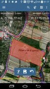
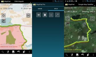
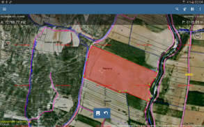
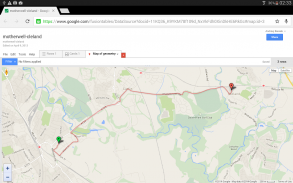
Calculate area of the field or a walk distance instantly using Google or Bing Map Satellite view. Save petrol and time and capture features with few clicks on the map.
Area & Distance measurements are very accurate - please compare with other apps and what's on the ground.
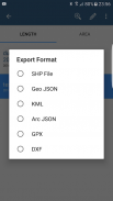
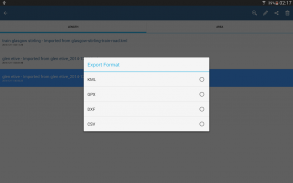
With MapPad you can capture, manage and share your data easily. App supports number of well-known cloud providers like G-Drive, Dropbox and export formats: SHP File, GeoJSON, ArcJSON, KML, GPX, CSV and AutoCAD DXF.
MapPad is a very useful tool for anyone involved in forestry, agriculture (measuring farms, soils, grow, check planted area etc.), roofing, solar panel planning and solar panel installation, fencing, construction, real estate management, asset management, winter snow removal or farming business.
MapPad also can be used in the whole range of outdoor activities like golf (distance meter and range finder), biking, walking, running, jogging and other sports where possibility of measure areas or distances is necessary.
Please visit our website to find out how to prepare offline map and get more information about this product.
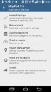
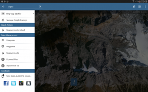
Selected features:
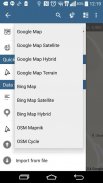
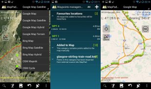
- Base maps: Google Maps (Standard, Satellite, Hybrid, Terrain), Open Street Map (Mapnik, Cycle), Bing Maps (Satellite, Hybrid, Roads).
- Google Maps Overlays (Custom WMS or ArcGIS Server Tiled service), some layers like US Topographic map have been predefined.
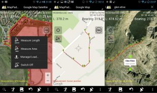
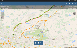
- Very accurate measurement of areas and distances.
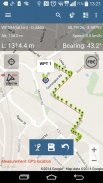
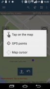
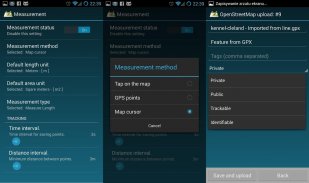
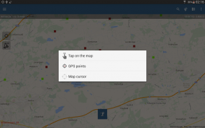
- 3 methods of measurement are supported (Tap on the map, GPS location, Map cursor location).
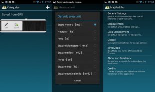
- Support for number of metric and imperial units.
- Support for several global and local coordinate systems: WGS84 (decimal or degrees), Web Mercator, British National Grid, UTM SAD69 (Brazil), UTM NAD83, NATO, Stereo70 (Romania), System 1992 (Poland), Greek Grid – if you require support for any other spatial reference please get in touch.
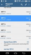
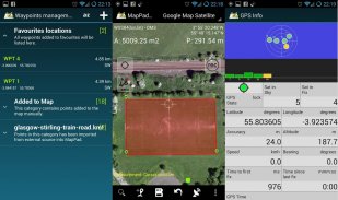
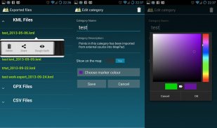
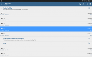
- Possibility to capture waypoints and group them in categories.
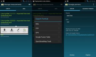
- Possibility to add\edit title and description for each recorded measurement and waypoint.
- Export single or multiple measurements or waypoints to SHP File, GeoJSON, ArcJSON, KML, GPX, CSV and DXF to SD Card or cloud services like Fusion Tables, Dropbox or Directly to Open Street Map.
- Share single waypoint location directly by SMS, E-mail or other ways.
- Elevation profile available for measurements done by GPS.
- Import of KML and GPX files to the application.
- GPS status and satellites status.
- Address, location search.
- Quick open exported KML files in Google Earth
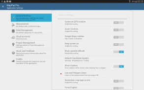
- Ability to set default measurement units, waypoints' categories colours, track recording time and distance interval, transparency of Google Maps overlays and much more...
Please note:
If you experience any problems or have new ideas or comments please do not hesitate to contact us directly or using the contact forms provided on our website. We take your opinion very seriously and do appreciate any form of feedback.
Our users are successfully using MapPad in number of applications including:
- environmental surveys,
- roofing and solar panel planning,
- calculations for snow removal,
- biking and walking routes planning,
- forestry planning and woodland management,
- agriculture and soils' surveys,
- road constructions,
- tree surveys</br></br></br></br></br></br></br></br></br></br></br></br></br></br></br></br></br></br></br></br></br></br></br></br></br></br></br></br></br></br></br></br></br></br></br></br></br></br></br></br></br></br></br></br></br></br></br></br></br></br></br></br></br></br></br></br>
Map Pad GPS Surveys & Measure - Version 7.5.0
(19-05-2019)
Map Pad GPS Surveys & Measure - APK Information
APK Version: 7.5.0Package: com.osedok.mappadLatest Version of Map Pad GPS Surveys & Measure
Other versions


Apps in the same category

You may also like...


